Translation Terroirs
Translation Terroirs
East Asia between Indigenous and Western Cartographic Languages
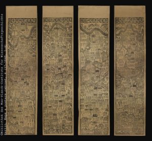
Maps sharing the same cartographic conventions and metric properties are comprehensible independently of their toponym’s language, whereas a translation of toponyms and legends does not help much for understanding an ‘alien’ cartographic image.
The project is focussed on cases of fusing cardinally different cartographic languages: mapping East Asia by indigenous and European cartographies, which since the late 16th century became engaged in a reciprocal translation process. Attention will be paid to what stays untranslatable (including entire maps), what is supplemented and transformed.
The selected cartographic sources are poorly known or new for scholarly community. Among them are printed maps recently acquired by the MPIWG and manuscript items in the possession of the SUB Göttingen.
This study is using formal methods of investigating maps, which rely on modern techniques of cartometric analysis and numerical modelling, as well as on techniques of analysing the materiality of maps.
The goal is to reliably reconstruct filiation of congener maps, which among other characteristics makes explicit fine links established between maps through reciprocal translations.
The three-year project is hosted by the MPIWG, benefitting from its highly qualified IT team. It is based on a cooperation of Prof Dr Dagmar Schäfer (Director of the the MPIWG Dept. III), Dr Vera Dorofeeva-Lichtmann (CNRS, France) and Prof Dr Yang Yulei (Zhejiang University, P.R.C).
Project website at the Max Planck Institute for the History of Science.
Publications (project-related):
